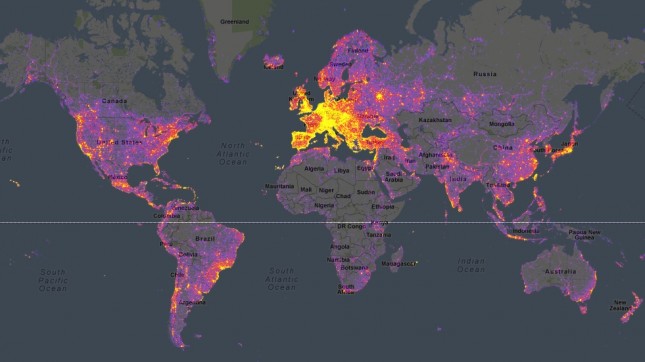
Using geo data from photos uploaded by users to Google’s Panoramio, Sightsmap generates an interactive heatmap of the most frequently photographed spots around the world. It reminds me a little of the Heat Map I made back in 2006, which could be applied to any geolocational data (including photos).